
BROOKINGS – This week’s rainfall set local one-day and two-day total records in Brookings, said State Climatologist Laura Edwards of South Dakota State University.
This item is available in full to subscribers.
To continue reading, you will need to either log in to your subscriber account, or purchase a new subscription.
If you are a current print subscriber, you can set up a free website account and connect your subscription to it by clicking here.
If you are a digital subscriber with an active, online-only subscription then you already have an account here. Just reset your password if you've not yet logged in to your account on this new site.
Otherwise, click here to view your options for subscribing.
Please log in to continue |
BROOKINGS – This week’s rainfall set local one-day and two-day total records in Brookings, said State Climatologist Laura Edwards of South Dakota State University.
She’s been working in climatology since 2001 and been the state climatologist for a year and a half.
The rainfall recorded in Aurora might break the standing state record for 24-hour rainfall total, she added.
The official Brookings weather station has been on the SDSU campus since February of 1893 and is the National Weather Service’s cooperative observer.
“The observations are made in the morning around 8 o’clock,” she said.
Rainfall was 6.83 inches at that station Thursday morning, and it continued to rain throughout the day.
“The two-day total is 7.08 inches and both of those – the one-day and two-day total – are the highest ever on record at Brookings, so in 125 years, that’s pretty significant,” Edwards said.
The next highest local one-day total was 5.54 inches on June 25, 1980, she added.
“Our state 24-hour record rainfall is 8.74 inches, so some of those rainfall totals we heard over in the Aurora area are pretty close to record territory,” Edwards said.
She collaborates with the National Weather Service on the process.
“I’m suspecting we will at least investigate a little further from the weather and climate perspective,” Edwards said of Aurora.
Rainfall totals varied widely, she added, with Volga reporting 2.5 inches.
The record-setting rainfall caught some folks by surprise, but it may become more common, Edwards said.
“Having more extreme rainfall events, that is consistent with the long-term trend, I think nationally, but also in this part of the country. We have seen increasing precipitation trends as well, but that has often been more in the spring and fall seasons, not so much in the summer,” she said. “But it is unusual to see this kind of event, no matter what.”
That goes for the whole summer, all over the state, Edwards said.
“This summer really has been unusual. We’ve had a handful of events across the state that have had 5 inches or more per rainfall event,” she said.
Edwards listed a 13-inch rainfall around the Selby area in May, 11 inches south of Aberdeen about a month ago, and the southeast part of the state, including Vermillion, Yankton and Sioux Falls.
“They’ve been really wet, too,” Edwards said.
“This summer has been really unusual in that we have seen several different events with five inches or more reported,” she said.
Summer isn’t the only time of the year that is seeing a change, she added.
“Our trend is that winters are getting warmer and not as severe, at least temperature-wise,” Edwards said. “Last year was kind of unusual in that it was colder than average, but over time, our average winter temperature has been rising and that’s a little different.”
Contact Jodelle Greiner at jgreiner@brookingsregister.com.
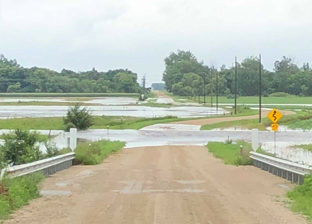
Brookings County Sheriff's Office photo:
Above, a bridge east of Aurora on 214th Street at about 10 a.m. Thursday morning.
Courtesy image:
Below, Data from High Plains Regional Climate Center, University of Nebraska-Lincoln


